|
1. Early History of St Augustine's Church
and Parish
The parish of St Augustine forms part of an historical administrative ward or leet of Norwich known as Ultra Aquam or Norwich Over-the-Water; the water in question being the River Wensum, which winds through the city ('Wensum' derives from an Old English word meaning 'winding' or 'to wend') like the letter S lying on its side before joining the River Yare a few miles southeast of Norwich at Whitlingham.
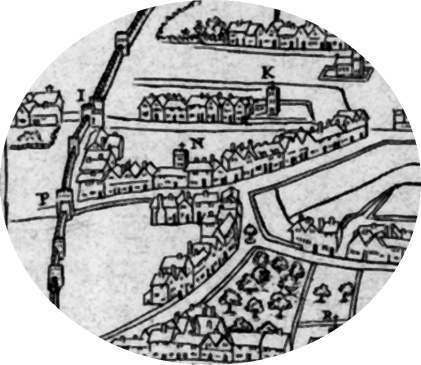
The parish today lies entirely within the northwest quarter of Norwich, as defined by its medieval boundary; bordered roughly by the northern end of Oak Street and St Martin's Road on its the west, St Martin's Lane (once also known as "Whores Lane") to the south, Edward Street and Botolph Street to the east and the line of the city's medieval wall to the north substantial fragments of which can still be seen in St Martins-at-Oak Wall Lane. This defensive structure, completed in the mid-14th century, effectively cut off manorial farmland known as the Gildencroft from Tolthorp Manor to the north. A complex pattern of ownership and usage would ensure that much of this area would remain open and rural well into the 19th century.
While no archaeological evidence of human habitation before the Roman period has been found locally, one of Norwichs earliest Saxon settlements may have been located near here, on high ground above the then rather swampy land north of the Wensum known as Coslany (a very old place-name that possibly means 'reed bog island'). Evidence for this is suggested by cinerary urns thought to date from the 5th-6th century AD, which were discovered by labourers digging drains in Eade Road a little to the north of St Augustines Gate in 1898. Pottery urns such as this were used by pre-Christian Anglo-Saxon peoples to hold cremation ash and grave goods of high status individuals.
By the 10th century, the area north of the river Wensum may have been economically thriving enough to support a mint. The earliest known record of the place-name Northwic (meaning north settlement), from which Norwich gets its modern name, occurs on a coin of 930 AD depicting the Saxon king, Aethelstan the First. 'North settlement' may indicate that it was minted somewhere north of the areas chief Saxon stronghold centred around a then shallow crossing point of the river known as Cunegesford (meaning The Kings Ford).
Evidence of pre-Conquest domestic settlement in the immediate vicinity of St Augustines church is sparse and mainly conjectural. Indeed, as one archaeologist put it in the 1970s, Norwich north of the river is an archaeological wasteland as 19th-century industrialisation obliterated much of the underlying archaeology and there has been little opportunity for deeper excavation. Pits dug in the Botolph Street area south and east of St Augustines churchyard during the Norwich Survey of the early 1970s, uncovered tentative evidence of a small Roman farmstead on the banks of the now lost stream or cockey known as the Dalimond or Dalymond Dyke, which was itself probably named after a small local mound or lookout hill. This stream once flowed south into what is now Norwich via the present-day Edward Street area. It is said to still be flowing underground, in gravel beds, exiting into the Wensum via a conduit at the bottom of Hansard Lane off Edmund Street in the Fishergate area of the city.
Alongside the Dalimond a wooded area known as the Mereholt (possibly meaning the 'pool by the wood' or the 'boundary wood') covered most of the area currently occupied by Anglia Square and Botolph Street car parks. A pre-Conquest Saxon defensive ditch was also discovered in the Botolph Street area, but no sign of domestic occupation earlier than the 11th century. Archaeologists have speculated that ditch and pale defences were hastily thrown up here in the late 10th century following the sacking of Ipswich by the Danes. However, whatever buildings existed here then (presumably mostly made of wood), including any pre-Conquest churches, would almost certainly have been lost when the Danish king, Svein Haraldsson (also known as Swein Forkbeard), father of King Canute, sacked and burned the entire burh (borough) of Norwich in 1004.
The Domesday Book compiled by the Normans in 1085/6 does not mention a church in Norwich dedicated to St Augustine. This does not necessarily mean that a church did not exist here before the Normans, probably with a different name; indeed, only six Norwich churches are named in the Domesday Book and these do not include a number with names or architectural features which suggest they existed before the Conquest of 1066, such as the Saxon round tower of nearby St Mary's Coslany church and the dedications of two other nearby but now lost churches to St Botolph and St Olaf (or Olaves), Saxon and Viking saints respectively. It has also been noted that St Augustines nave without its aisles (much later additions) has Saxon proportions, being tall and narrow. This may suggest that the present church stands on the site of an earlier structure. Fragments of blackened lava stone quoins in the exterior west gable of the nave may be all that survive above ground from this putative church. Without archaeological excavation beneath the church the question of whether or not another building stood here before the 12th century will probably remain unanswered. |


.jpg)